


© Jon Sharpe, 2013
(Continued from Part 1 of this series, "The Journey Begins.")
I began my tour at the end, the mouth of the Elwha River where it meets the Strait of Juan de Fuca. I went at low tide because I'd heard that sediment trapped behind the dams for 100 years was being carried downriver and turning the rocky shore into a sandy beach. It looked like a typical Pacific Coast Beach to me. Although the river seemed swift and muddy, I wouldn't have known what an extraordinary event I was witness to.
A large sandbar divided the river at the Strait. A pair of retired men walking on the beach told me that a month ago, the sandbar wasn't there. Long-time residents of Port Angeles, they had been against taking out the dams. But now that it's happened, they're excited by how the ecology of the river is changing. The Elwha is muddy because it's carrying the sediment from the upper river to the beach, the estuary, the near-shore bottom land, and eventually 2 miles east to Ediz Hook, the sandspit that shelters Port Angeles harbor. The sediment is rebuilding the beach and the shore and providing needed habitat for salmon and shellfish.
I drove south, tracing the Elwha upriver. Hwy 112 crosses the river via the Elwha River Bridge. The Olympic Discovery Trail traverses the river by a walkway suspended under the bridge, The state fish hatchery and the Elwha Water Facilities Project are on the east side of the bridge. The hatchery rearing ponds were empty, the juvenile salmon having already been released. This Water Facilities Project was built for the city by the National Park Service and includes a water treatment plant and other features to protect the quality and availability of water from the Elwha for municipal and industrial use. It was expressly built to stave off possible adverse impacts of dam removal on the city's water supply. Ironically, it is closed right now because it is clogged with river sediment from the dam removal. In fact, deconstructing the last 50 feet of Glines Canyon Dam is held up until the Water Facilities Project is up and running.
Continuing up the river, I hiked a short trail from a parking lot off Hwy 112 to an overview of the Elwha Dam site. It would have been an impressive view of the dam, close enough to hear the turbines. All that remains is a bare hill and the river.
My next stop was the Former Lake Aldwell Access, former site of a boat launch, where I actually walked on the lakebed. The kayak rental and boat ramp were remnants of the old fishing and recreation destination. Now a sign warns, No Boating. The river is low and cloudy, with sticks and logs below the surface that make it dangerous. There's no fishing on the Elwha either, to give fish runs a chance to recover. I walked out onto a plain of stony rubble, scrub grass, buttercups, and old stumps. After a half-mile hike, I heard, then saw, the river cutting a new channel. Streaks of red - precipitated iron - and green - algae - stained the many side channels. How amazing to stand in a place that was underwater for 100 years. There is a beautiful cedar house on the bluff which must have had an expansive view of Lake Aldwell. I'm guessing the owners weren't happy when the lake disappeared. Retracing my steps, the terrain looked the same everywhere and I was glad to find the boat ramp and my car.
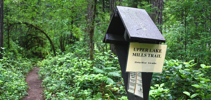
The beginning of the hike down to see where Lake Mills used to be.
Driving farther up the Elwha Valley, I found the picturesque, unstaffed Elwha Ranger Station, dropped my National Park Entrance Fee in the box, and turned onto remote Whiskey Bend Road (wondering how it might have gotten its name). From there it was a 5-mile drive on a single-lane, unpaved road winding uphill through the forest, then a steep half-mile downhill hike on the Upper Lake Mills Trail to the Former Lake Mills Overview of the south, far end of what was long, narrow Lake Mills. The overview was 15 feet above the river; the sign warning that the riverbank is unstable was punctuated by a clump of alders hanging horizontally over the dropoff. The narrow lakebed extended as far as I could see, full of stumps and gravel, with a long streak of iron staining the riverbank. The height from river to treeline must be 30 feet, the depth of the former reservoir. The Elwha rushed downhill in two channels that met on the lakebed, and there were sandbars where the river traversed the lakebed. The Elwha wasn't muddy here; I was upstream of where the dams were; the color of the river was a glacial teal.
The next thing I wanted to see was the Glines Canyon Dam, but it is closed until dam removal is complete, projected to happen by September 2014. A chain link fence covered with black plastic was installed along Whiskey Bend Road at the dam overview and there was nowhere to pull over safely to try to peek through. The National Park Service brochure Elwha River Restoration includes a map showing sites on the river and spots in Port Angeles where I found lots of helpful information.
The Elwha River restoration is all about the saving the salmon. The key to saving the salmon is restoring their habitat. This means spreading the fine sediment a few inches thick for nine miles along the Elwha, from the upper dam to the Strait. This kind of restoration has never been done on such a scale. It's a huge experiment. Scientists built computer models of what they thought the river would do as the dams came down, but would their predictions happen? Already the state-of-the-art water treatment plant is clogged with sediment and thousands of juvenile hatchery salmon have been killed because of poor water quality - twice. I wondered, after my first day visiting the Elwha, "What will happen next?"
Next, in Part 3 of this story: How did we get here? The History of the Elwha River Dams.
-- Marilyn Hair