

Duwamish Valley
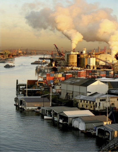
The urban and industrialized Duwamish Valley spans the length of the lower Duwamish River between West Seattle and Beacon Hill. The Duwamish Valley has one of the most diverse populations in the state, with 65% non-white residents and more than 30 languages spoken in the local schools. The mean household income is among the lowest in Seattle. Air quality in the Duwamish Valley is poor, with some of the highest PM2.5 and diesel emission levels in Seattle. Air quality-related diseases like heart disease and childhood asthma are disproportionately high, and life expectancy in the riverside neighborhood of South Park is eight years shorter than Seattle’s average. In addition, the Duwamish Valley is home to more than 100 hazardous waste sites and the Lower Duwamish Waterway (LDW) is a federal Superfund Site. Three freeways and two rail lines bisect the valley, which lies within the flight path of two airports, and the waterway itself is a marine freight corridor. Finally, the greatest impacts of sea level rise in the greater Seattle area are expected in the Duwamish Valley, with extreme flooding projected in both residential and industrial riverfront lands during high tides. The U.S. Environmental Protection Agency has designated the Duwamish Valley’s South Park and Georgetown neighborhoods as “environmental justice” communities.
Extensive planning for environmental health conditions has been conducted by community-based organizations like the Duwamish River Community Coalition, as well as government agencies like the City of Seattle’s Duwamish Valley Program. Environmental health research conducted to date includes the Duwamish Valley Cumulative Health Impacts Analysis and Health Impact Assessment of the Superfund Cleanup Plan for the Lower Duwamish Waterway.
Projects
UW student researcher, Erynne van Zee (MLA), developed a StoryMap in response to the Duwamish River Community Coalition's request for a portal synthesizing all air quality data available for the Duwamish Valley. van Zee worked with DRCC to refine the content, ensure accessibility, and translate the site into Spanish for the Latinx community. DRCC and their partners use the StoryMap to share existing data and studies about air quality in the Duwamish Valley and identify research gaps.
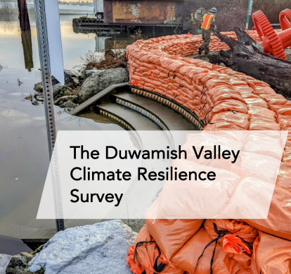
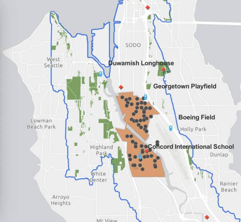
In 2022, the Duwamish Valley Youth Corps, University of Washington, Public Health Reserve Corps, and the City of Seattle went door to door, surveying community members in South Park and Georgetown to assess and build climate resilience strategies tailored to their local conditions and needs.
Data collected and lessons learned from the project will drive future city equity-centered approaches to disaster needs assessment; resilience planning; and climate mitigation and adaptation strategies.