Rita Colwell and her collaborators have successfully used satellite data to predict cholera outbreaks in Yemen, Sudan, Malawi and other places where the bacteria that cause the diarrheal disease lurk in zooplankton in the ocean. When ocean conditions are right, the zooplankton build up and can transfer the bacteria to people through contaminated water or seafood. Cholera outbreaks include up to 4 million people and kill up to 143,000 worldwide each year, but early warning of conditions favorable for outbreaks can help prevent them.

Colwell, an award-winning microbiologist at the University of Maryland who was the first woman to lead the U.S. National Science Foundation, will be giving the 2025 Omenn Lecture in Environmental Health on “Oceans, climate and health: The cholera model” on April 17.
Colwell’s groundbreaking research began at the UW, where she earned her PhD in marine microbiology in 1961. But all might have gone differently — if not for a residency rule put in place by the UW Medical School and help of an early computer. We caught up with her recently to hear about her early days at the UW, her recent research, and her advice for young scientists.
Tell me about how the work you did as a graduate student at the UW started you on a path to develop computer models to predict cholera outbreaks.
I had been accepted to the medical school at the UW and intended to go, but the ruling was that you had to be a resident of Washington state, Idaho, Oregon or British Columbia for at least a year prior to your acceptance. I was in Indiana, so that wasn't going to work. I was offered a research assistantship in microbiology which I accepted instead.
I ended up working with John Liston, then a UW fisheries professor, on the microbiology of marine animals including oysters and fish, because those were the main commercial products of Washington state. Vibrio species — including Vibrio cholerae, the bacterium that causes cholera and the type species for the genus Vibrio --- comprise the community of microorganisms associated with them.
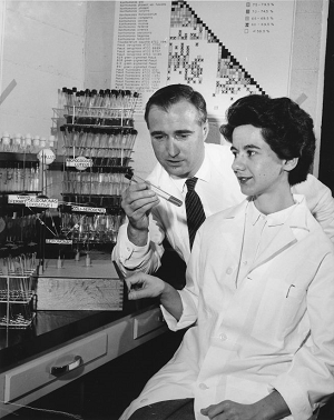
While I was there, the first computer arrived. It was an IBM 650, a model of which is now in the Smithsonian. It was installed in the attic of the chemistry building, and it got air conditioning, though the rest of the campus didn't. Graduate students were allowed to use it between midnight and 6 a.m.
I wrote a computer program, numerical taxonomy, to cluster the microorganisms into species. This was pre-genomics and I wrote the program with collaboration of my husband's colleagues in physical chemistry. That was the beginning of computer identification and description of microorganisms. And because of the peculiar ruling of the medical school, I probably have saved more lives with the work on cholera than I ever would have done as a physician.
How do you use satellite data to predict cholera outbreaks today?
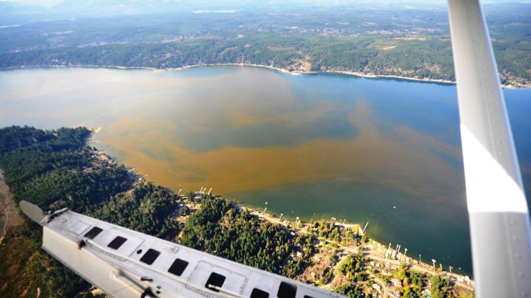
The bacterium that causes cholera is associated with zooplankton in the ocean. We can predict outbreaks using the association of temperature and salinity with the growth of phytoplankton, which carry the pigment chlorophyll and can be analyzed by satellite sensors.
Phytoplankton are the food of the zooplankton, so the peak in zooplankton populations follows the peak in the phytoplankton, and then shortly thereafter, outbreaks of cholera occur in places like Bangladesh and India.
Today we run these major analyses with much more sophisticated satellites, computation models, and AI to make predictions of risk in various countries for the United Nations.
I believe satellite sensing is a useful tool for public health application, especially since 50% of the world's population lives along the coast.
How have you used this approach to predict cholera outbreaks in real time?
In 2017, we did a retrospective analysis of an outbreak in Yemen that had already occurred, and we showed that we could have predicted it with our model. We were asked to help agencies in the United Kingdom and in the UN, by providing four-week and then six-week prediction maps for Yemen.
We were able to demonstrate the geographical region where the epidemic was occurring, Thus we could pinpoint the highest risk of cholera geographically. The public health authorities could then locate medical supplies, personnel and safe water ahead of time, before the epidemic peaked. And many lives could be saved.
While doing our analyses in Yemen, we began picking up signals in Sudan, a neighboring country. Because the satellite sensors are so sensitive, we could pinpoint the source of the water in Sudan, where the outbreak later occurred. Thus, we had an early warning.
Similarly, in Malawi, we picked up signals strongly suggesting conditions optimum for cholera and were able to alert the UN. That was in June of 2023, and by August, there were many cases, but assistance was available when needed.
“I believe satellite sensing is a useful tool for public health application, especially since 50% of the world's population lives along the coast.”
- Rita Colwell
Are there any surprises that you've found along the way, like places that you wouldn't have expected to have cholera outbreaks that that you can see with this technique?
We have been monitoring places like Gaza to determine if there would be an outbreak, and we were able to assess that if they were to have a heavy rainfall, all the other conditions of population density and environmental parameters were rich for a major outbreak, as if they didn't have enough problems already.
We also picked up signals in Ukraine, along Mariupol on the coast, but the other parameters were not indicative of an outbreak.
What other waterborne illnesses could you use these methods to predict?
We're beginning to analyze environmental parameters associated with salmonella, shigella, cryptosporidium and giardia. If we can gather sufficient data from satellite sensing and the literature to create a computational model, we should be able to predict risk of outbreaks of these diseases.
We've also done some work, by including wastewater testing for COVID-19, to predict not just risk of an outbreak, but how severe it would be.
How does climate change impact these issues?
We have shown that the increase in sea surface temperature over the last 40 years in the North Sea and North Atlantic along the coast of the U.S. is correlated with increased numbers of Vibrio species, and also correlated with cases of vibriosis infections reported to health authorities in Europe, England and New England.
In Florida, water temperatures off Miami have reached as high as 90° to 100° F. During a hurricane, the environmental conditions of temperature and salinity are similar to those we use in the laboratory to enrich for Vibrio bacteria. There were 11 deaths in Florida after Hurricane Ian caused by another Vibrio species, Vibrio vulnificus, and twice as many after the more recent Hurricane Milton. Thus, we're finding climate change is a big factor.
You’ve been a trailblazer throughout your career as the first woman to lead the National Science Foundation and much more. What’s your advice for young scientists?
My main advice is to persevere. If you really love what you're doing, then persevere, which is what I'm doing. I've always been determined that there was a way around every obstacle, and I have learned to use humor, rather than anger — not always successfully, but most of the time.